Saturday, 18 August 2012

THE PILBARA

After leaving Port Hedland, we headed inland for about 60 kms south to Indee Station and camped there for a couple of nights.  This part of the Pilbara is pretty flat and open.  The station had mustered cattle the day before we arrived and had them penned in the home yards.  Next morning the animals were loaded onto trucks and shipped out.

The owners of the station (though I think most cattle runs in WA are leasehold), Colin and Betty, put on happy hour daily for staff and travellers - free nibbles provided, bring your own drinks - which is a good opportunity to chat with other campers.  Few of the station staff were able to join us at that time as most were recovering from a severe viral illness, or otherwise occupied with cattle.  Colin has had the station for 50 years and, at 74, also works two days a week in the mine.  Camping facilities were basic, but adequate.

The main attraction at Indee Station is Red Rock where many ancient aboriginal petroglyphs can be seen.  We found them difficult to locate, but after some time scrambling over the hot rock, we were eventually successful.

Red Rock


View over Indee Station from Red Rock

View of campground from nearby hill
Indee Station was also the site of a 1968 aeroplane crash in which 28 people died.  A wing of the plane sheared off and crashed into the fuselage, evidently due to some creative but faulty aircraft maintenance in Perth. (http://en.wikipedia.org/wiki/MacRobertson_Miller_Airlines_Flight_1750) There is a memorial to the crash victims near Red Rock together with bits and pieces of the wreckage.

Travelling inland further south along the Great Northern Highway, the flat terrain is increasingly dotted with low hills.  There seems to be a mine located everywhere there is a low red hill or two.  Road trains ply the road and a railway line runs mostly parallel to the road where trains of enormous length ferry their cargo of Pilbara rock to port.  Dig it up and ship it out!

From the road we could see a few camps for miners - rows of dongas plonked down on the dirt under the blazing sun, and it's still winter here.  I'm told they work 12 hour shifts with maybe one day off each month.  Their accommnodation may be a room little larger than a walk in wardrobe with room for a bed, a small fridge and not much else.  What a life!


KARAJINI NATIONAL PARK

We'd heard a lot about how fabulous Karajini was - best National Park in WA according to many - but driving in to the fairly flat, spinifex covered campground made me wonder what the fuss was about.  Allocated a site on crushed red rock without any shade was not very encouraging either.  However, it seems that Karajini is all about the gorges.  Near Dales campground is Dales Gorge.  A steep climb down (of course, it's a gorge) leads to Circular Pool, then further on, the pretty Fern Pool where maidenhair ferns grow wild.  At the other end of this gorge is Fortescue Falls.

Fern Pool

The eponymous vegetation


Fortescue Falls


Circular Pool
There are no fossils in these rocks as they were formed from lava about 3.5 million years ago before there was life on earth.  You just have to look at these rocks and you can pretty much see that they're full of iron.  Try picking up even a small one and it's extremely heavy.  There is also supposed to be asbestos in this gorge.


Forty-two kilometres along a teeth-chatteringly corrugated dirt road was the most spectacular gorge, series of gorges really, that we have ever seen.  It made us wonder how breathtaking it must be to see the Grand Canyon.


The wildflowers were out, but those lining the road were covered in red dust and struggling to survive.  I thought that by now I was an old hand when it came to dealing with red dust. Generally it just brushes off, but the red dust at Karijini was different, not the sort you could brush off, but the sort that stuck.  We were all walking around with our clothes smeared with red dirt.


Driving west from Karijini, we crossed the Hammersley Range to Tom Price.  The range is mostly made up of hills  rounded by erosion, not as spectacular as the Kimberley perhaps, but interesting none the less.


Sunday, 12 August 2012

PORT HEDLAND

A mining town - actually two towns - with South Hedland about 18 kms away.  Port Hedland is the deep water port for shipping out mine products extracted by BHP, Rio Tinto and Fortescue Metals.  This morning I counted 13 large cargo ships standing off shore, presumably waiting to receive their cargo.


Rio Tinto has a large salt producing works here:


While people working in the mining industry make good money, they seem to work very long hours and accommodation is difficult to get and very expensive.  The asking price for ordinary looking houses is in excess of $1.5 million.  The young woman who cut my hair in South Hedland was renting a small unit for $900 per week and she and her partner had to share this unit with another couple!  The old Detention Centre is currently being used to house workers.


View from behind our van, looking towards South Hedland
There's not much to spend money on in this town.  Neither Port nor South Hedland boasts a book shop.  At least Broome had two good book shops.


Old quarters for medical staff
 Tomorrow we're heading south to Indee Station, then on to Karijini National Park.

Saturday, 11 August 2012

DERBY TO EIGHTY MILE BEACH via BROOME

DERBY (CONT'D)
Before leavng Derby we visited the old boab prison tree which had been used as a temporary lock up.  Aboriginal people from west Kimberley were kidnapped by blackbirders, or evicted from stations, chained together and marched to the coast where some were used as divers for the pearling industry.

Located about 35 kms south of Derby, in the middle of nowhere, is the Curtin Detention Centre at the site of the disused Curtin Airforce Base which reputedly has the biggest and thickest runway in the southern hemisphere.  The idea was that this runway could serve as an alternative landing site for America’s space shuttle.  There is talk that the Americans may use this base to land the heavy equipment for their proposed Darwin base and then truck the equipment overland, seemingly a logistical piece of cake for the Yanks.
We were told that Curtin Detention Centre currently houses about 800 males – Afghans, Iraqis, Iranians and heaven knows who else.   Yesterday the temperature at Curtin was 34 degrees and from now on it will only be getting hotter.  Little wonder that such a place produces so much mental illness.

BROOME
The town of Broome didn't hold a lot of attraction for us.  It's a very touristy place with old and new corrugated iron sheds and shops, with many shops in the business of flogging pearls.

Broome claims to have on display the "World's largest fine quality round pearl":


There is the old outdoor picture theatre

and, of course, famous Cable Beach


with its camel rides


and spectacular sunsets:


We were lucky that on our second morning, there happened to be a very low tide so the dinosaur footprints at Gantheume Point were visible.  Along with a couple of dozen other early risers, we managed a 7 am scramble over rocks down the cliff to view and photograph these prints - yep, more dinosaur relics.


A highlight of our time in Broome was a visit by my friend, Mary.  It was good to see someone from home and catch up on the news.

We all enjoyed a trip to Roebuck Bay Bird Observatory, east of Broome.  Thousands of migratory shore birds visit Roebuck Bay annually, many of them from as far away as Siberia.  This is supposed to be the most significant site in Australia for shore birds.  Unfortunately, we visited at low tide when there were few shore birds to be seen on the water, but there were plenty of bush birds around, as well as some native wildlife.


Our last night in Broome coincided with the 'Staircase to the Moon' phenomenon where the reflection of the full moon rising over the mud flats of Roebuck Bay gives the illusion of a staircase up to the moon, but our camera was not good enough to capture the full effect.

CAPE LEVEQUE
We had been thinking about taking the tent and camping on the Dampier Peninsula for a few days.  In the end we opted for a (very) full day tour - picked up at 7 am and returned at 9.30 pm.  This turned out to be a good decision as the first half of the drive (about two hours) is on a badly corrugated road.  As well, the whole road to Cape Leveque is away from the coast and straight through the middle of the peninsula's bushland, so there's not a lot to see until you get to the top, unless you turn off on one of the side roads to the coast.
Altar decorated with mother of pearl at Beagle Bay Church

Inevitably on a tour, you're taken to a place that wants to sell something.  In this case it was Cygnet Bay Pearl Farm, though I must admit that the descriptions of pearl seeding, growing and harvesting were interesting.
Cygnet Bay
At One Arm Point we visited Ardiyooloon Hatchery:


Then, late in the afternoon, arrived at the indigenous owned and operated Kooljaman Resort.
From Kooljaman Resort at Cape Leveque

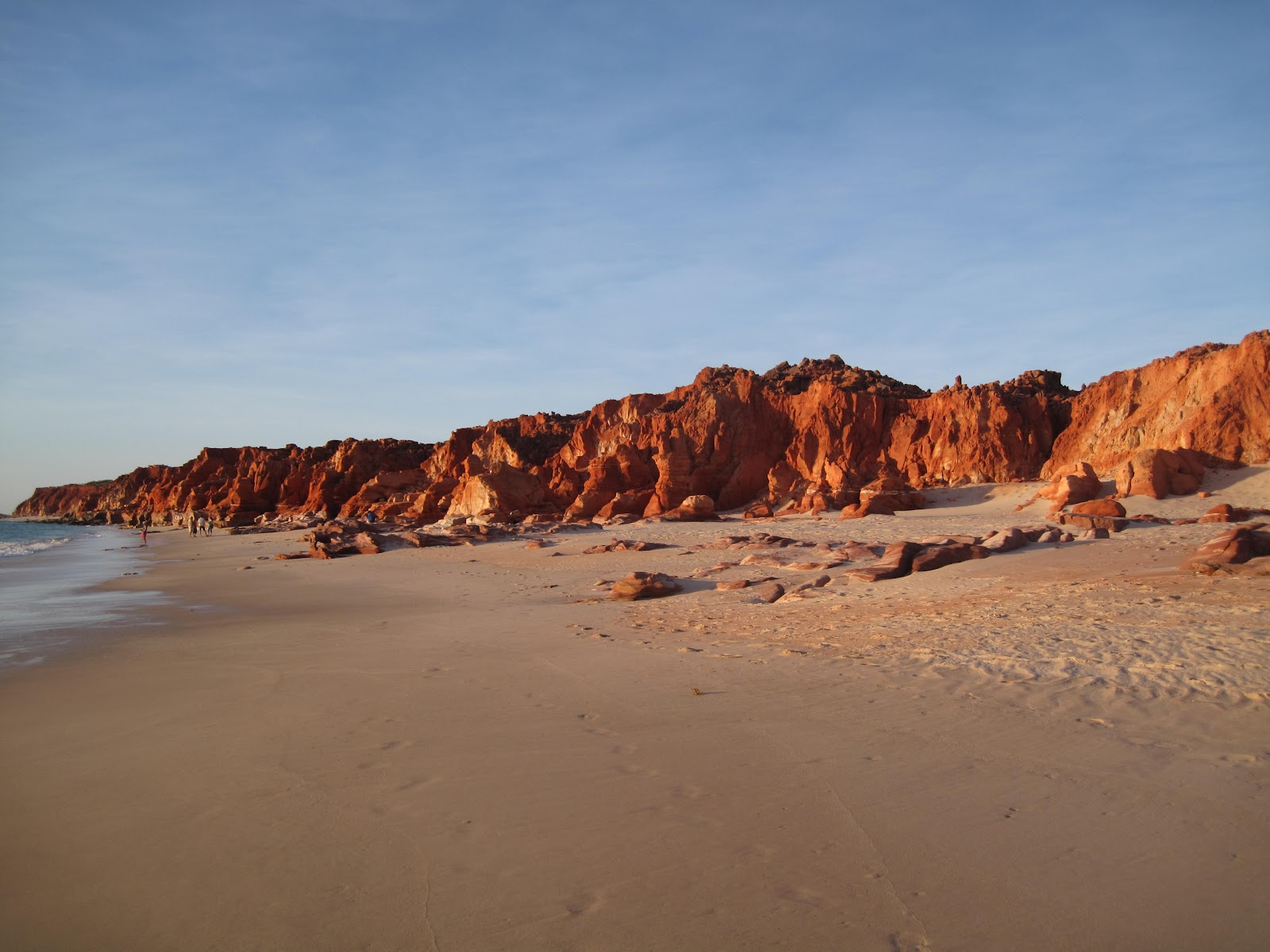
Sun setting over cliffs at western beach, Cape Leveque

PORT SMITH

About 140 kilometres south of Broome and 23 kms off the highway along a good dirt road is Port Smith.  The camp ground is situated near a mangrove lined lagoon where the swimming is good at high tide.  At low tide there is a long walk out over mud flats to reach the water.  The sand flies feasted on me and I'm still scratching.


Driving around the coast revealed some spectacular coastal scenery


and strange birds


EIGHTY MILE BEACH

Further south down the highway is the turnoff to Eighty Mile Beach located on a cattle station about 10 kms in along a somewhat corrugated dirt road.  White sand and shells, torquoise water and a temperature of 32 degrees, but you can't swim!!!  So what do you think people do?


Some people did venture into the water but, as they were catching sharks off the beach, we contented ourselves with paddling.